
“Do I Need A Topographical Survey?” This question often arises in the minds of property owners and developers when embarking on new construction projects or land developments. A topographical survey, also known as a topo survey, is a detailed mapping of a specific area, showcasing its natural and man-made features. These surveys are essential tools in land development and construction projects, offering crucial insights into the terrain and surroundings.
Understanding whether a topographical survey is necessary can significantly impact the success and efficiency of a project. This introductory section aims to shed light on the importance of topographical surveys and help readers discern whether they need one for their upcoming ventures.
In this guide, we’ll explore the definition of topographical surveys and delve into why they are indispensable in various development endeavours. From understanding the lay of the land to facilitating efficient project planning, topographical surveys play a foundational role in ensuring the success of construction projects. So, let’s dive in and find out if you need a topographical survey for your next project.
Understanding Topographical Surveys
What is a Topographic Survey?
A topographic survey is a detailed mapping process that carefully records contour lines, elevation points, and various other features of the land, encompassing both natural and man-made elements.
These surveys provide architects, engineers, and developers with essential data required for creating precise site plans and construction designs. By meticulously capturing the terrain’s characteristics, topographic surveys lay the foundation for informed decision-making and effective project execution.
Objectives of Topographical Surveys
The primary objective of a topographical survey is to gather comprehensive data necessary for making informed decisions during the planning and development phases of a project. By meticulously identifying and mapping out all the features of the land, including structures, trees, and elevation points, topographical surveys serve as crucial tools in determining the feasibility and cost-effectiveness of a new project.
This detailed information from the data collected with the topographic survey enables architects, engineers, and developers to assess the terrain accurately, anticipate potential challenges, and optimise design solutions, ultimately contributing to the successful execution of the project.
When Do I Need a Topographical Survey?
When is a Topographical Survey Necessary?
Topographical surveys become necessary whenever a new construction project is proposed on a specific site. They are particularly crucial when dealing with complex terrain or when specific details are required for planning and construction purposes.
For example, if the proposed site has significant elevation changes or existing structures, a topographical survey provides invaluable insights into the land’s characteristics. Additionally, topographical surveys are essential when accurate data is needed to address regulatory requirements or environmental considerations.
Benefits of Conducting a Topographical Survey
Conducting a topographical survey offers numerous benefits for architects, engineers, and developers involved in a construction project. By providing a detailed map of the proposed site, topographical surveys enable stakeholders to accurately determine the cost and feasibility of the project.
They help identify any potential challenges or limitations of the land, such as drainage issues or soil conditions, allowing for proactive planning and mitigation strategies. Moreover, topographical surveys facilitate informed decision-making by providing precise data on existing features, enabling designers to optimise site layout and infrastructure placement for maximum efficiency and functionality.
Overall, the benefits of conducting a topographical survey extend beyond the initial planning stages, ensuring smoother project execution and minimising risks associated with unforeseen obstacles.
Topographical Survey Process
Steps Involved in Conducting a Topographical Survey
At TPD Solutions, our topographical surveyors begin with a meticulous examination of the site by our team of experienced land surveyors. Equipped with state-of-the-art total stations and other advanced tools, we meticulously collect data on various features of the land. This includes recording elevation points, contours, structures, vegetation, and other relevant details.
Once the data is gathered, our experts diligently process and analyse it to create detailed maps and reports. These comprehensive documents provide a clear representation of the site’s terrain, enabling architects, engineers, and developers to make informed decisions during the planning and design phases of the project.
Tools and Technologies Used in Topographical Surveys
In conducting topographical surveys, TPD Solutions employs a range of cutting-edge tools and technologies to ensure accuracy and efficiency. Traditional instruments like total stations and GPS receivers are utilised to collect precise location data, allowing us to accurately map out the features of the land.
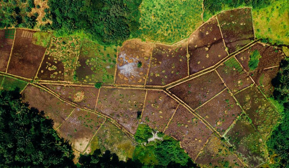
Moreover, we leverage advanced technologies such as LiDAR (Light Detection and Ranging) and drones for aerial surveys, particularly in inaccessible or large areas. LiDAR technology enables us to capture high-resolution elevation data, while drones offer unparalleled flexibility and accessibility, allowing us to gather comprehensive data from various vantage points.
By utilising these sophisticated tools and technologies, TPD Solutions ensures that our topographical surveys deliver precise and reliable results, empowering our clients to make informed decisions for their projects.
Topographical Survey Cost
Understanding the cost of a topographical survey is crucial as it can vary based on factors like the size and complexity of the land. However, it’s essential to view it as an investment in the triumph of your construction project.
By meticulously gathering all the necessary data with precision and attention to detail, a topographical survey sets the stage for informed decision-making and the smooth execution of your project.
Don’t hesitate to get a quote from us today. Whether you’re dealing with intricate terrain or expansive landscapes, our team at TPD Solutions is here to provide you with reliable and accurate surveying services. Simply fill out the form on our website or reach out to us directly at John: 085 254 5380 or Eva: 085 211 2747.
Hiring a Topographical Surveyor
Why Choose TPD Solutions for Your Topographical Survey?
At TPD Solutions, we stand out as your premier choice for topographical surveys in the Midlands, seamlessly integrated into our property conveyancing service. With a collective experience of 40 years, our team boasts unparalleled expertise and knowledge in delivering accurate and reliable survey results. When you partner with us, you can trust that your project will be in capable hands.
If you’re in need of a topographical survey in Laois or nearby counties such as Dublin, Kildare, Offaly, Carlow, and Kilkenny, look no further than TPD Solutions. Contact us today to discuss your project requirements, and we’ll be delighted to provide you with the professional assistance you need to bring your vision to life.